
Canvassing Using RunningMate + Google My Maps
Summary: Users can create and export a list from RunningMate, then upload the list into Google MyMaps via a computer. From there, they can create a walk or drive-list to use on their mobile device while canvassing. The link to the map can be shared. Clicking it will sync to the user's Google Maps navigation app, for ease of use.
Note: Users can also log in to RunningMate via their mobile device to search for individuals as they are canvassed, then update support scores and tags. Read more here.
Read these helpful articles published by the Google MyMaps team for more detailed instructions on creating and managing maps:
- Manage your Maps in Google Drive
- Use map layers
- Share, download, or print your map
- Delete a map from My Maps
- View your MyMaps in Google Maps
Creating a new map:
First, use your web browser to search the phrase, “Google MyMaps”, or click here. That will bring up a site that looks like the screenshots below. Click the red button that says, “Create a New Map”.

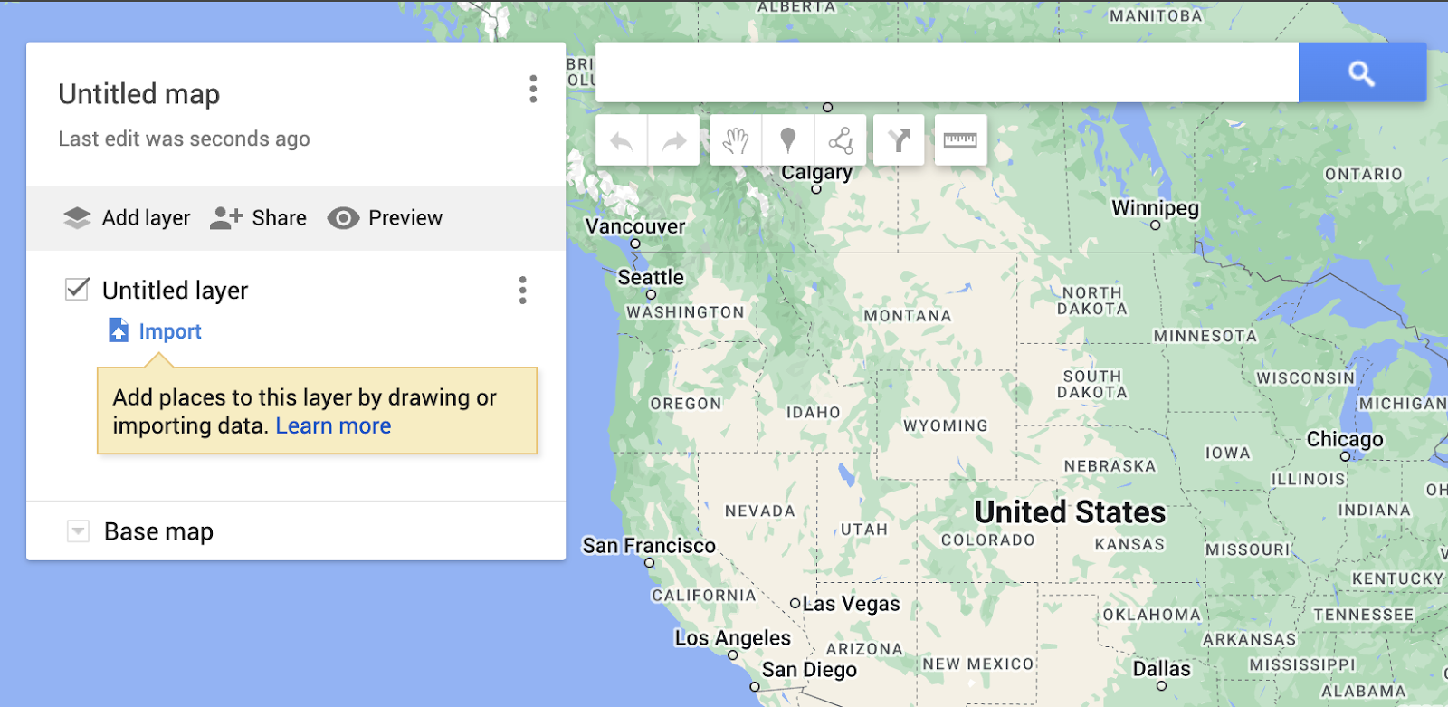
This will bring up a blank map of the United States, with a panel titled “Untitled Map”
Change the name of the map to one that suits your purposes. Here are a couple of examples:
- Precinct 1001, Turnout Canvass 08/2024
- 8/15/2024 Unregistered, 18-35yr
Click the blue Import button, under the section called “Untitled Layer”
Once you choose the file to import, it will show a preview of the columns included in that sheet and ask you to click the checkbox to designate which of those columns show the address or longitude and latitude. Choose the address columns, including zip code.

You will then be asked to choose which column the records will be labeled by on the map. In this example, I chose first names.

At this point users can share the link to this map with themselves by clicking the Share icon. When they open the link from their phone, it will open using the Google Maps navigation app (as long as it's installed on the device). Users can select from their phone which target to canvass first and Google Maps will help navigate to that point.

Alternatively, users can pre-select their route while on the computer's web-browser by clicking the split-arrow icon below the search bar, near the ruler icon.

This will open a Directions section, labeled A and B. Choose your starting point as point A, then your second stop as point B. Add other targets by clicking Add Destination, to add targets C, D, E, and F.


Sharing the map:
Review the Google My Maps help documentation here, or continue reading for a summary.
Share a link to the map with yourself or others by clicking Share. Opening this link from a mobile device that has Google Maps installed as a navigation app will allow users to view and navigate to the target locations.

Toggle on Anyone with this link can view.

Get step by step directions by choosing that option from this menu by choosing Step-by-step directions.


After the canvasser has chosen their route, they can they can also click Share to create a link that they can then open up in Google Maps on their device to use as they drive or walk their route.
Use Navigation in Google Maps on your mobile device to navigate to the points on the map!
Google Maps will assist canvassers as they navigate to the addresses on the list. Read more in this help article, written by the Google MyMaps team.
Leave paper lists behind!

- Use Google Sheets to open the canvassing list as a spreadsheet.
- All of the canvassers helping that day can update the New Support Score and New Tags columns of the spreadsheet as they make contact and gain feedback from potential voters. As long as the device is connected to the internet, the spreadsheet will live-update for all users who have access to that sheet.
- After the canvassing is finished, simply download the it as a CSV then upload it back into RunningMate.
- Use the Data Management tool to import the list to view in the platform.
- Remember, the Support Scores will affect the goals set in Goal-Tracker.
- Tags added into the platform can be included or excluded when filtering lists
- Use the Data Management tool to import the list to view in the platform.
Related articles: