
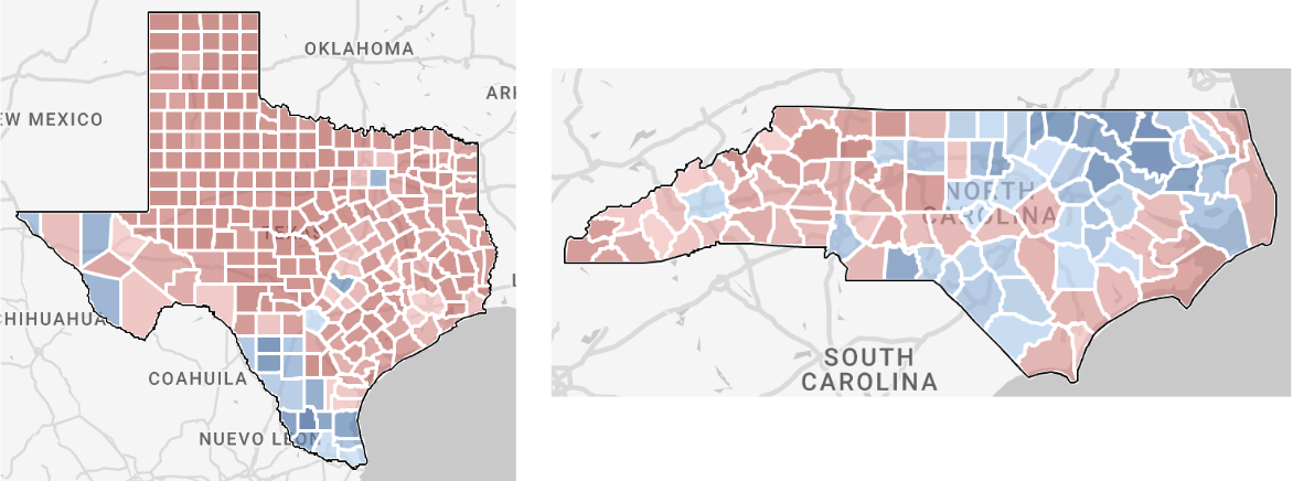
Statewide view in RunningMate
State View introduces a third layer of geography in the form of the full state map.
In this structure, the state is the default 'active' district, which means it is the district that defines the scope of data that can be analyzed. Much like the district/precinct setup, an active district has sub-geographies that can be selected and deselected for analysis in the target summary panel.
However, the user can only filter for sub-geographies immediately below the active district in the geographic hierarchy. For example, if the state view is active, the user can filter by county (or one of the other three district types) but not by precinct. The user can only filter for associated precincts when they activate a specific county district.
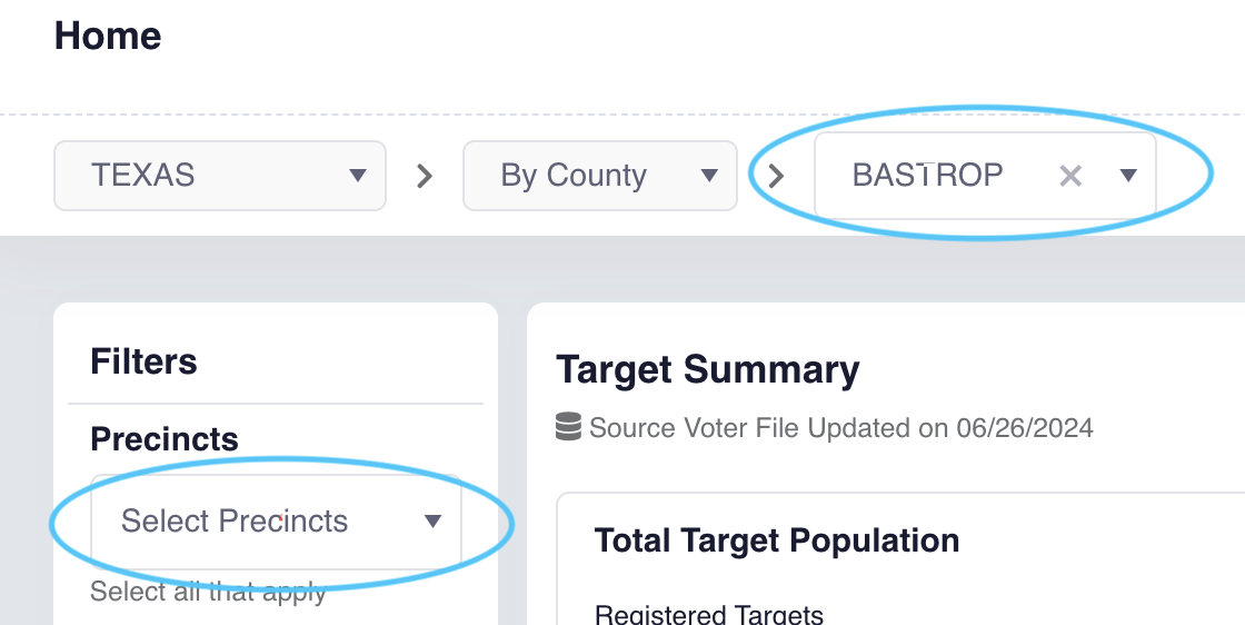
When in state view there will be three drop-downs across the top left for users to select which geography they want to explore.
- State > District Type > District
- District types available in state view:
- Congressional
- County
- State Assembly
- State Senate
- By default County is selected as the district type and the map will display the state shape with counties within it
- District types available in state view:
Navigation
In State view you can select or activate geographic entities.
Selection
Selecting a geographic entity functions similarly to filtering the data set you are analyzing and updates the Target Summary Panel (like how it works now when a user clicks on a precinct).
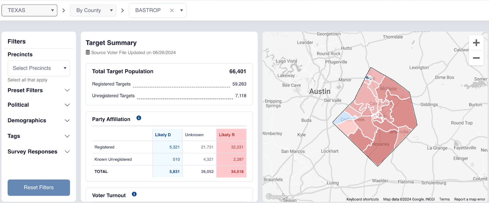
If for example you have County as the District type, when you click on a county, the map will zoom in to that county, the Target Summary will update with stats for that county, and that county will be listed in the filter panel under the “County Districts” filter.

Activation
Activating a geographic entity (e.g. a specific county or State House district) will update the map to only display the map of the selected county or State House district with precincts within it. The Target Summary panel also updates and displays data for the activated geographic entity.
Any filtering done is filtered on the activated geographic entity. Precincts are only shown on the map and available to be filtered on once a user has activated a specific district (an option is selected in the third dropdown of the top left navigation).
Filter Persistence
With the exception of the precinct filter, all set filters will persist when the user switches district types or selects another district within the state view.
Users can clear any filters by removing them or through the Reset Filter button. Filters do not persist when navigating to another State or when navigating to another district outside of state view (e.g. User has a state district and a place district in their account).

Restricted Features
Canvassing is currently not available in RunningMate. If using a statewide district and you need canvassing functionality, please contact support@civitech.io and the team will add other district types, like Congressional or county-level, into the workspace.
Other helpful articles: